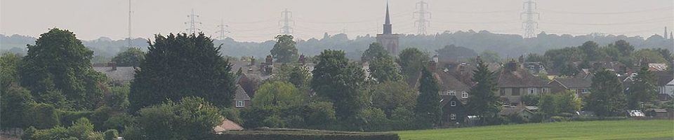
Below are Photos and Aerial Video showing the sites within the Baldock area which will be affected by the proposed NHDC Local Plan development.
All of these areas will need consideration as part of Neighbourhood Planning within Baldock, Bygrave and Clothall.
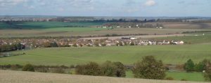
Sites south of Baldock – BA2 & BA3
BA2 is the area of land just below the Mobile Homes site, extending down to the A507 Buntingford Road, west of the Baldock Southern Bypass.
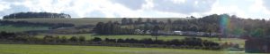
View from A507 Buntingford Road, looking across site BA2, up towards the Mobile homes and Weston Hills.
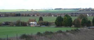
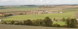
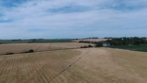
Looking across site B2, towards B3 and Clothall Common, with BA1 & Bygrave in the far distance.
Below is an Aerial video of BA2, looking down on the BA2 proposed housing area (200 homes). Starting over the allotments, passing south along the A507 Buntingford Road, with the Bypass on the left (south), and the Mobile homes site in the middle distance.
BA3 is the area of land south of Clothall Common estate, extending from Tapps Garden Centre across to Baldock Bypass, and south towards the A507 Buntingford Road, near the Allotments.
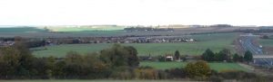
View from Westen Hills, with BA2 in near distance, BA3 in middle distance towards Clothall Common, with the Baldock Bypass to the right (south) and Tapps Garden Centre on the left (north). In the far distance is the BA1 land, towards Bygrave village.
Below is an Aerial video of BA3, looking down on the BA3 proposed housing area (200 homes). Starting east of Clothall Common, passing west along the Baldock Bypass towards the A507 Buntingford Road. Tapps Garden Centre can be seen in the near distance, with BA1 & Bygrave in the distance.
Sites north of Baldock – BA1 & BA10 & BA4
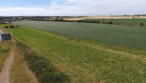
Walking from Royston Road roundabout, over proposed BA10 industrial land to the railway. The BA1 land north of the railway extends into the distance
Walking from Royston Road roundabout, over proposed BA10 industrial land to the railway, and across BA1 land up to Bygrave. Some BA1 land can be seen north of the railway
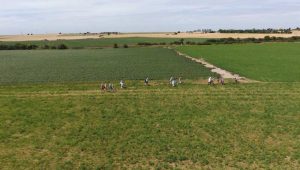
Walking from the railway, across BA1 land up to Bygrave. More BA1 land can be seen to the west of Bygrave.
Below is an Aerial video of BA1, looking down on the BA1 proposed housing area (2800 homes) to the North of Baldock. Starting from North Road, passing east across 177 hectares of farming land, almost to Bygrave. The railway forms the southern boundary of BA1, and the bridle way the northern boundary.
Photo of walk around BA10 & BA1 looking back to the railway
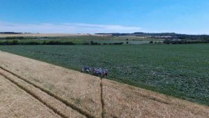
Photo from BA1 looking back over fields to Railway, across to Clothall BA4, and up to Weston Hills, above BA3.
Below is an Aerial video of BA4 & BA10, looking down on the BA4 proposed housing area (95 homes) to the south of the Royston Road, adjacent to Clothall Common. The camera passes west over the proposed Business area BA10, between the Royston Road and the Railway.
Full details of each Site and the number of proposed houses per site can be seen on the Maps page