This page contains links to various maps of Baldock, Bygrave & Clothall.
Enclosed below is a link to the map from NHDC showing the boundary for the Baldock, Bygrave & Clothall Neighbourhood Planning area
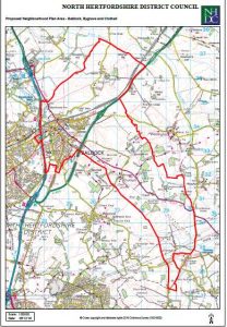 – the map includes Luffenhall, which is part of Clothall Parish area.
.
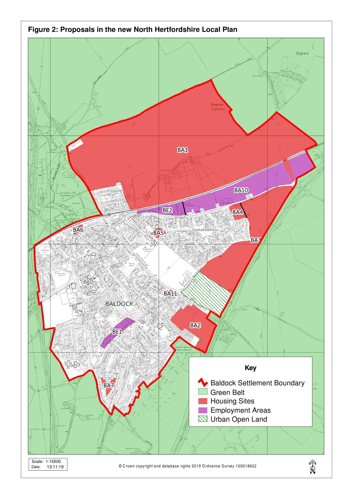 NHDC development sites proposed for Baldock in the 2019 Local Plan – Site map revised by NHDC in 2019
Links to the 2017 Local Plan maps are available in the NHDC examination library.
Detailed below are the BA development areas referenced on the maps, and the NHDC estimated houses to be built per site
BA1 Land North of Baldock (currently HCC green belt) 2,800 homes
BA2 Land west of Clothall Road (Clothall parish) 200 homes
BA3 Land south of Clothall Common (Clothall parish) 253 homes
BA4 Land east of Clothall Common (East of Rhee Springs) 42 homes
(Planning Permission still to be granted – see BA4 site for more details)
BA5 Land off Yeomanry Drive 25 homes
(Outline Planning Permission for 23 houses granted by Planning Committee on 18th Nov 2021 – see Item 26)
BA6 Land at Icknield Way 26 homes
(Completed – Retirement Home has been built )
BA7 Land to rear of Clare Crescent 20 homes
(Outline Planning Permission for 24 houses granted by Planning Committee on 4th Nov 2021 – see Item 17)
BA8 & BA9 Works, Station Road and adjoining Raban Court 50 homes
(Completed – houses and flats built, now occupied )
BA10 Royston Road New employment area – allocation
BA11 Deans Yard, South Road 20 homes
For more information regarding each area above, see detail on the SRB website
https://www.saveruralbaldock.co.uk/?page_id=586.
Selection of other maps and details of Baldock, Bygrave & Clothall
.
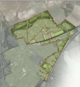
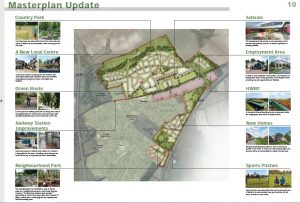 Baldock HCC earlier 2017 Masterplan boards @ 6-7-oct 2017
.
General details of Baldock, including Bygrave & Clothall – on Wikipedia –
wikipedia.org/wiki/Baldock
Map of Baldock and surrounding areas – Open Street map –
openstreetmap.org/#map=13/51.9863/-0.2011
Baldock – Old map, and Village details circa 1870-72 –
visionofbritain.org.uk/place/30
Bygrave – Old map, and Village details circa 1870-72 –
visionofbritain.org.uk/place/2447
Clothall – Old map, and Village details circa 1870-72 –
visionofbritain.org.uk/place/1981